Note: version 1.2 is the latest version of
ICE-5G,
but PMIP2/MOTIF participants absolutely have to use the ICE-5G v1.1 version!
ICE-5G is a new global ice sheet reconstruction produced by W.R
Peltier of the Department of Physics in
the University of Toronto, Canada.
The model differs significantly from the previous version (ICE-4G and see also
PMIP
newsletter 3) at all Northern Hemisphere locations that were
glaciated at Last Glacial Maximum. These locations include all of
northwestern Europe/Eurasia, the British Isles, Greenland and the
North American continent.
The VM2 designation refers to the radial variation of
viscosity in the sub-lithospheric mantle.
The files available here pertain to ICE-5G (VM2) Version
1.2.
The topography is now based on the ETOPO2 present-day topogragraphy data, and the ICE-5G v1.2 data files are only available at a 1x1 degree resolution (and 5x5 minutes for 0K and 21K).
The PMIP2/MOTIF participants absolutely have to use the ICE-5G Version 1.1 version!
All papers that employ the ICE-5G reconstruction should reference the following publication in which the complete model is first described:
| Peltier, W.R., Global glacial isostasy and the surface of the ice-age Earth: the ICE-5G (VM2) model and GRACE. Annual Review of Earth and Planetary Sciences, May 2004, Vol 32, 111-149. |
Prior publications describing the detailed analysis which has led to the modifications of the ice-sheet topography in the individual geographic regions are as follows:
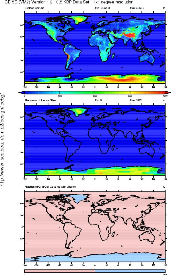
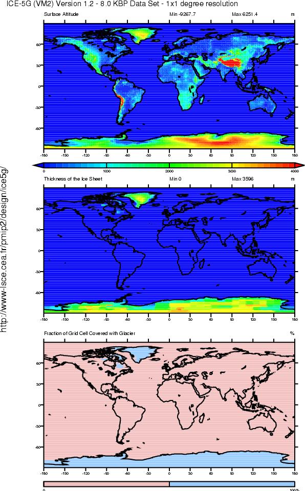
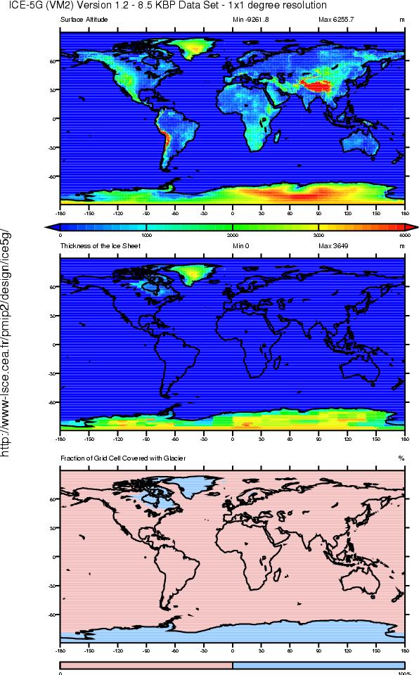
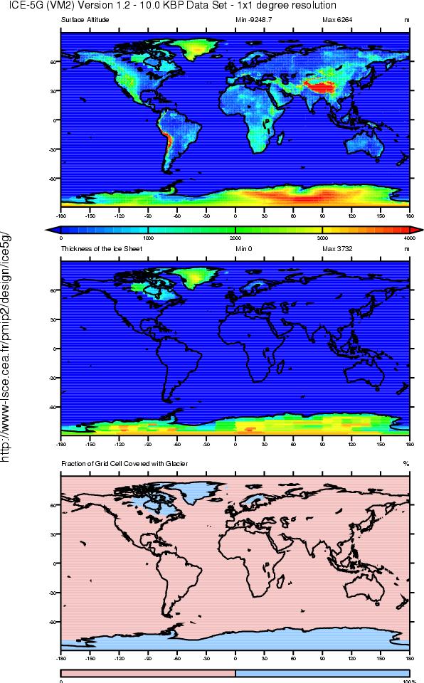
The topography is based on a dataset for the present-day topography from the October 2001 NOAA/NGDC 2-Minute Gridded Global Relief Data (ETOPO2).
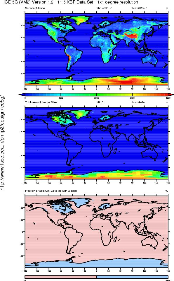
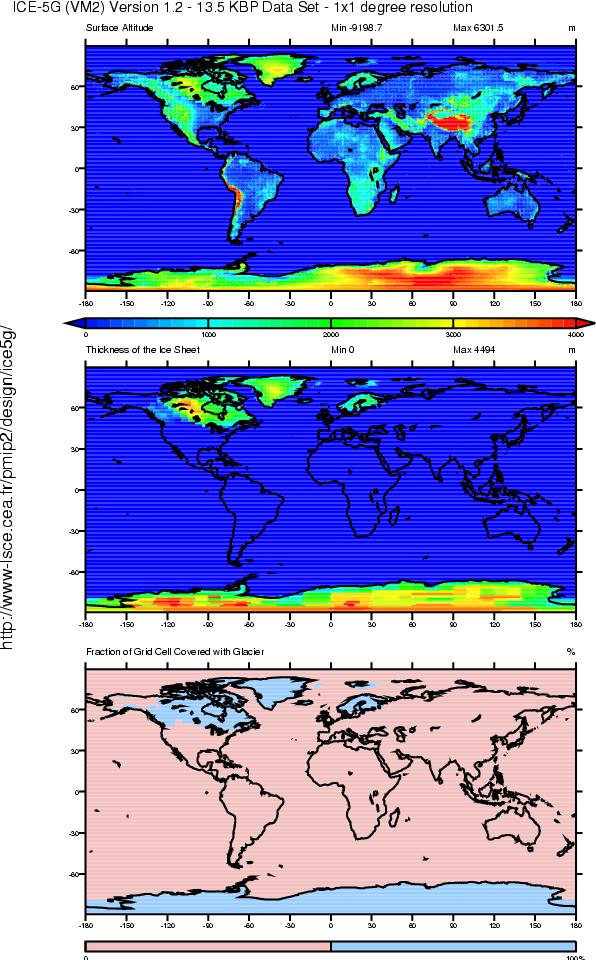
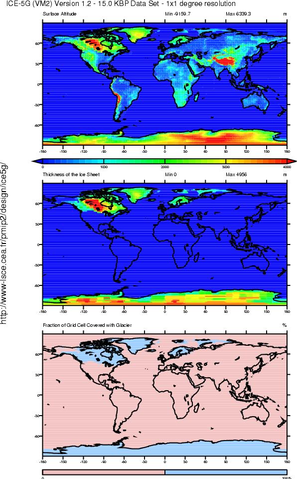
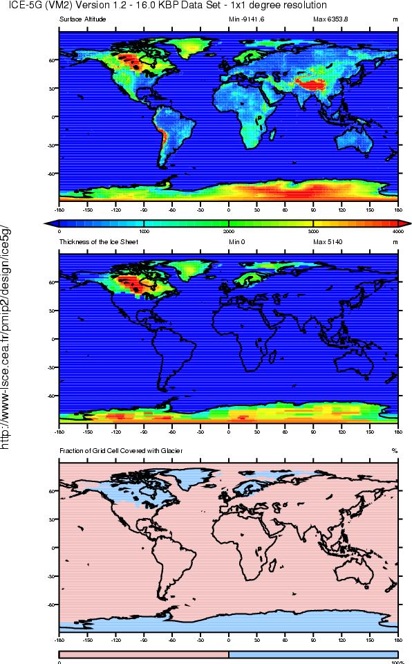
The data files are provided in netCDF format, and follow the CF (Climate and Forecast) metadata convention. The files are available every 500 years from 0K to 17K, and then every 1000 years. Each file contains a topography (orog), ice height (sftgit), and ice-mask (sftgif) variable.
| Variable | Long name | Standard name | Units |
| orog | Surface Altitude | surface_altitude | m |
| sftgit | Thickness of the Ice Sheet | land_ice_thickness | m |
| sftgif | Fraction of Grid Cell Covered with Glacier | land_ice_area_fraction | % |
If you have technical questions about the data files, please get in touch with Rosemarie Drummond and Jean-Yves Peterschmitt.
For people who care about things such as consistency and try to be friendly with web indexing sites and robots, let us say that we should only use ICE-5G (see the '-' between ICE and 5G?)when we are referring to this global ice sheet reconstruction! :)